2026. Local Plan /Housing updates
A Statement from the Harpenden Society Feb 19th
550 new homes in NW Harpenden
This approval flies in the face of the realities of the geography of the A1081, and the negative impact on the traffic and town centre infrastructure arising from a development of this size cannot be understated.
Moreover, the quantum involved is almost double the number of houses that have been included for this site in the Local Plan, now with the Planning Inspectorate.
Furthermore, we note that this application appears to have been heavily influenced by the recent policy shift that recognises ‘Grey Belt’ land. This looks to the Society as a rabbit being pulled out of a hat, as the officials’ view appears to have been turned by this, without any sign of a robust challenge.
It is more than disappointing to see SADC councillors approving this project as presented, without attempting to defend the Local Plan figure put forward for this site.
The Society are not Nimbys, in that we recognise and accept the need for more housing in our area. This is why we have been supportive of that Plan.
However, we have been equally clear that any major development needs to recognise fully the impact it has on a community whose infrastructure, particularly the road system, town centre parking and rail capacity are already stretched.
We have consistently demanded that for any large scale development in the town, the infrastructure issues must be addressed at the same time as planning permission is formally sought. Those authorities involved, SADC, Herts County Council, NHS, the utility companies etc, must recognise and commit to the necessary improvements as a condition of the planning permission being granted.
This approval is woeful in that the infrastructure needs are being left to the usual ‘negotiation’ between the developers and SADC officials. Hopefully, we will see a more robust approach being adopted by officials in that negotiation,
Finally, one point worthy of mention is the inadequacy of the Herts Highways analysis that has come to light.
Highways understanding the realities of the location is underwhelming, with only one day’s observation of traffic flows taken at random. None of the reference sites they used are of a comparable size, and no recognition has been given in their support for the project of the traffic realities today – nor the impact on the town centre (not least in terms of parking), access to rail facilities, routes to employment centres, schools or health facilities. And most damning of all, of the reference surveys they quote, 7 of the 11 are pre 2010, and 3 are pre 2014.
Their conclusion that the increase in the number of daily car journeys that the 550 houses will generate is, frankly, laughable
Last but not least, this site, together with the one proposed for North Batford, suggests an increase in our community’s population over the next few years of approaching 5000 – an increase of over 15%. This appears lost on the transport planners, and their colleagues in education, social services and health. It’s about time Herts County Council recognise the overall impact that this increase in population will generate.
Below is the site plan.
Monday Feb 17th.
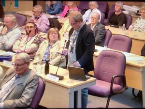
A meeting of the planning committee ( below) at St Albans City & District Council voted by five votes to four to grant outline planning permission for the development in Harpenden of 550 homes in green belt fields adjacent to Cooters End Lane and Ambrose Lane. Submitted by Legal & General who own the land.

Feb 19, The story - with national implications - was featured on the BBC News web site,.
Click on the link to read all the background.

Sept 9. Local Plan for sustainable growth of St Albans District is adopted
A Local Plan for the sustainable growth of St Albans District over the next 15 years has passed its final hurdle and been adopted.
St Albans City and District Councillors voted to approve the detailed document at an extraordinary meeting on Wednesday 9 September.
The decision came after two independent Planning Inspectors, appointed by the Government, subjected the Local Plan (LP) to a two year-long examination before declaring it met all legal and policy requirements.
The LP is the product of more than four years of work including extensive public consultations with feedback from residents and stakeholders helping to shape the final document.
BELOW
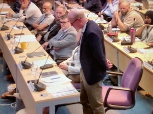
Pictures from the Council Meeting on Wednesday night
It identifies land for future development and allows for the building of 15,000 new homes in the District at carefully selected sites.
This figure conformed to Government guidelines at the time and includes 1,200 social rent properties.
The LP also provides for £750 million of new infrastructure including eight primary schools, four secondary schools, public transport improvements, green spaces and health facilities.
New commercial areas have been identified with the potential to create thousands of jobs to boost the local economy.
The LP includes measures to tackle climate change by encouraging active travel, reducing emissions, improving biodiversity and protecting the environment.
It also provides much-needed protection against speculative planning applications to develop land not included in the document.
The District's last LP was the oldest in England having come into force more than 30 years ago. Previous attempts to produce one for current times had failed.
Councillor Paul de Kort, the Council's Leader who oversaw the LP process, said after the meeting:
This is a hugely significant moment for the Council and for the District that we serve.
Producing a Local Plan is one of the most important, challenging and complex tasks a District Council undertakes, and I thank everyone who has worked so hard to complete this task.
This Local Plan provides homes for new generations, the social infrastructure vital for sustainable communities and the commercial space needed to create new jobs. Policies to provide green spaces and tackle climate change are at its heart.
Some of the growth will be concentrated in the East Hemel Hempstead area which we are developing with our partners Dacorum Borough Council. Hemel Garden Communities straddles both local authority areas and will be home to integrated neighbourhoods with a self-sustaining economy including Hertfordshire Innovation Quarter.
Of course, there are elements of the Local Plan that not everyone is happy about, but we did not shirk from making the tough decisions that were necessary and I am pleased that full Council has now voted to adopt it.
Our statutory duty was not to be people pleasers, but to produce a Local Plan that conformed to the law and national planning policies, including the method for assessing housing need, and we have done that as the Planning Inspectors verified.
Late in the plan-making process, revisions were made to some national planning policies by the Government, including housing need assessments.
Consequently, work has already begun on another Local Plan to conform with those changes.